
Imagine being able to see the world in a completely new way, uncovering insights hidden beneath the surface. That’s the power of geospatial technology. It’s more than just maps; it’s about understanding relationships, patterns, and trends within geographic data. For businesses and organisations across Australia, leveraging the right kind of geospatial data services can unlock a wealth of opportunities, from optimising operations to making smarter, more informed decisions.
But what exactly are geospatial services, and how can they benefit you? Let’s delve into the world of geographic information systems (GIS) and explore the transformative potential they hold. From environmental monitoring to urban planning, the applications are virtually limitless.
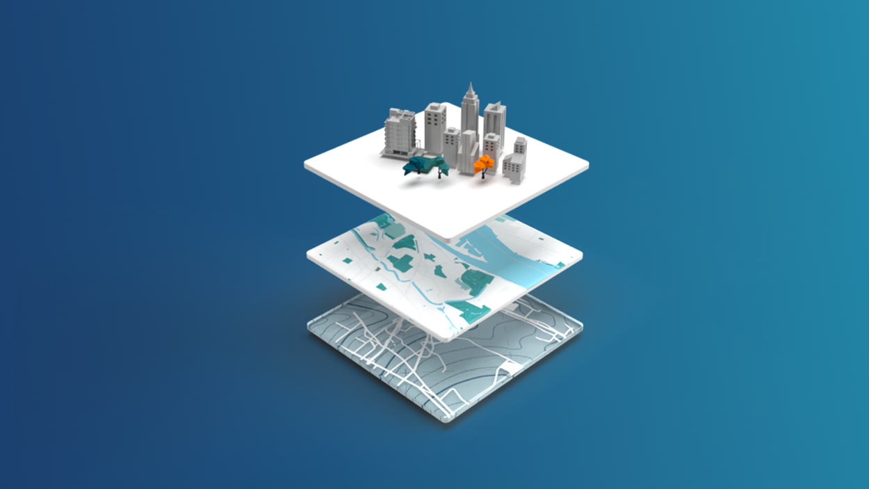
What are Geospatial Services?
At its core, geospatial technology deals with data that is associated with a specific location. This data can come from a variety of sources, including satellites, drones, aerial photography, and even ground-based surveys. Geospatial services encompass the tools, technologies, and expertise needed to collect, analyse, and visualise this location-based information. Think of it as a way to give your data a ‘where’ component, adding a crucial layer of context and understanding.
These services typically involve:
- Data Acquisition: Gathering geospatial data through surveying, remote sensing, and other methods.
- Data Processing: Cleaning, transforming, and organising raw data into usable formats.
- GIS Analysis: Using GIS software to analyse spatial relationships, identify patterns, and create models.
- Mapping and Visualisation: Creating maps, reports, and other visualisations to communicate geospatial information effectively.
The Benefits of Using Geospatial Services
So, why should Australian businesses consider investing in geospatial services? The advantages are numerous and can impact various aspects of an organisation. Here are just a few key benefits:
Improved Decision-Making
Access to accurate and up-to-date geospatial data empowers decision-makers to make more informed choices. For example, a retail company could use GIS analysis to identify optimal locations for new stores based on demographics, traffic patterns, and competitor locations. Similarly, local councils can leverage geospatial information to better plan infrastructure projects and manage resources effectively.
Enhanced Operational Efficiency
Geospatial technology can streamline operations and improve efficiency across a range of industries. In agriculture, precision farming techniques, powered by GPS and remote sensing, allow farmers to optimise irrigation, fertiliser application, and crop yields. In logistics, geospatial data can be used to optimise delivery routes, reduce fuel consumption, and improve customer service.
Better Risk Management
Understanding spatial relationships can help organisations better manage risks associated with natural disasters, environmental hazards, and other potential threats. For example, insurance companies can use GIS to assess flood risk and determine appropriate premiums for properties in vulnerable areas. Emergency services can use geospatial data to plan evacuation routes and coordinate response efforts during emergencies.
Effective Environmental Monitoring
Geospatial services play a vital role in environmental monitoring and conservation efforts. Remote sensing data can be used to track deforestation, monitor water quality, and assess the impact of climate change. GIS analysis can help identify areas of high biodiversity and prioritise conservation efforts.
Improved Urban Planning
Geospatial technology is essential for effective urban planning and development. GIS can be used to analyse population density, land use patterns, and infrastructure networks. This information can help planners make informed decisions about zoning, transportation, and public services.
Applications of Geospatial Services in Australia
The applications of geospatial services are diverse and span across numerous industries in Australia. Here are some specific examples:
- Mining: Geospatial data is used for exploration, resource management, and environmental monitoring in the mining industry.
- Agriculture: Precision farming techniques, powered by GPS and remote sensing, are used to optimise crop yields and resource use.
- Infrastructure: GIS is used for planning, designing, and managing infrastructure projects, such as roads, bridges, and pipelines.
- Environmental Management: Geospatial technology is used to monitor water quality, track deforestation, and assess the impact of climate change.
- Emergency Services: GIS is used to plan evacuation routes, coordinate response efforts, and assess damage after natural disasters.
The Role of Photogrammetry
A key component of many geospatial projects is the application of photogrammetry techniques. Photogrammetry is the science of obtaining reliable measurements from photographs. In the context of geospatial services, this often involves using aerial or drone imagery to create detailed 3D models of the Earth’s surface. These models can then be used for a variety of applications, including:
- Creating topographic maps
- Generating digital elevation models (DEMs)
- Measuring volumes of stockpiles or excavations
- Inspecting infrastructure
The accuracy and efficiency of modern photogrammetry techniques make it an invaluable tool for geospatial professionals.
Choosing the Right Geospatial Service Provider
Selecting the right geospatial service provider is crucial for ensuring the success of your project. Look for a provider with:
- Experience and expertise: A proven track record in delivering high-quality geospatial services.
- Technical capabilities: Access to the latest geospatial technologies and software.
- Industry knowledge: A deep understanding of your specific industry and its geospatial needs.
- Customised solutions: The ability to tailor services to meet your unique requirements.
- Strong communication: Clear and consistent communication throughout the project lifecycle.
Investing in professional assistance with geographic data provides a real advantage.
The Future of Geospatial Services
The field of geospatial technology is constantly evolving, with new innovations emerging all the time. Some of the key trends shaping the future of geospatial services include:
- Increased use of drones: Drones are becoming increasingly popular for aerial surveying and data collection, offering a cost-effective and flexible alternative to traditional methods.
- Advancements in remote sensing: New sensors and algorithms are enabling the collection of more detailed and accurate geospatial data.
- Integration with artificial intelligence (AI): AI is being used to automate geospatial data processing and analysis, improving efficiency and accuracy.
- Cloud-based GIS: Cloud-based GIS platforms are making geospatial technology more accessible and affordable for businesses of all sizes.
As technology continues to advance, we can expect to see even more innovative applications of geospatial services in the years to come. Consider the power of geographic data when making important decisions.
Conclusion
Geospatial services offer a powerful toolkit for understanding the world around us. By leveraging location-based data, Australian businesses and organisations can unlock hidden insights, improve decision-making, enhance operational efficiency, and better manage risks. Whether you’re in mining, agriculture, infrastructure, or any other industry, exploring how expert help with geospatial information can benefit you is well worth the investment. It’s about seeing the bigger picture and making smarter choices based on real-world data.